Thanks to Dominic Sexton &
http://www.software-developing.de
It has been recommended that the three points should be the Best L/D, Vne & a point approximately halfway between the first two. Using this recommendation, you would then pull the speed and sink values for each of these points off of your glider polar. V1/S1 should be the Best L/D, V3/S3 should be Vne & V2/S2 should be the point in between.
Another useful repository of glider "3-point" polar information is the "Polars" area on the WinPilot homepage (www.winpilot.com).
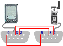
The picture below shows what pins to connect together to allow the two devices to talk to each other. With my Garmin 12XL I use a standard HotSync cable on the pilot, then I bought a Garmin data cable without a PC-type connector on it (Garmin round connector on one end, wires on the other) and put my own DB9 male connector on it with the correct pinouts. If you have another type GPS, you should be able to purchase a similar data cable and make your own.
A more complex description of what the pin-out requirements are for connecting
the GPS to a PC (including power) can be found at:
http://www.gpstom.de/GPS/garcon.htm.
You can actually buy pre-made cables pretty cheap for connecting the PalmPilot (and most other handhelds) to Garmin GPS round and eTrex connectors at: Blue Hills Innovations. Just click on the "Pfrankly Speaking button", then on the "Products" link, then scroll down to the "Handhelds" section.
Now that SA (Selective Availability) has been turned off, the general answer to this is Yes. GPS altitude is at least as accurate as the reading from a barometric altimeter. However, to determine altitude a GPS MUST be receiving information from at least three satellites and the more it is tracking, the better. If you want more information on this subject, there have been NUMEROUS postings on the rec.aviation.soaring and sci.geo.satellite-nav newsgroups. I encourage you to check them out. In addition, the newest generation of handheld GPS' can now make use of the FAA's Wide Area Augmentation System (WAAS) in the United States. Using WAAS, accuracies of less than 3 meters.
Basically, the barometric pressure in the atmosphere does not decrease evently as you climb. In addition, barometric pressure is not constant for given altitude eveywhere. Given this, it is not uncommon for an altimeter to read around 200 feet lower than GPS altitude when flying at around 3000-4000 feet AGL. So, that means that technically GPS altitude is more accurate. However, as with the accuracy question above, there have been numerous discussions on this subject on the rec.aviation.soaring and sci.geo.satellite-nav newsgroups. In addition, GPS altitude is an MSL calculation. It has been said that the Height Above the Ellipsoid (HAE) will provide a value closer to pressure altitude. MSL is the default altitude reference but can be changed to HAE on the Final Glide settings page.
With version 1.7, use of the internal Soaring Pilot waypoints for all final glide/speed to fly calculations makes using these add-on GPS units possible.
Since the SoaringPilot is entirely developed by volunteers in their spare time features will be added as time allows. If you send the changes to soaringpilot@spatscheck.com they might be included in the next release.
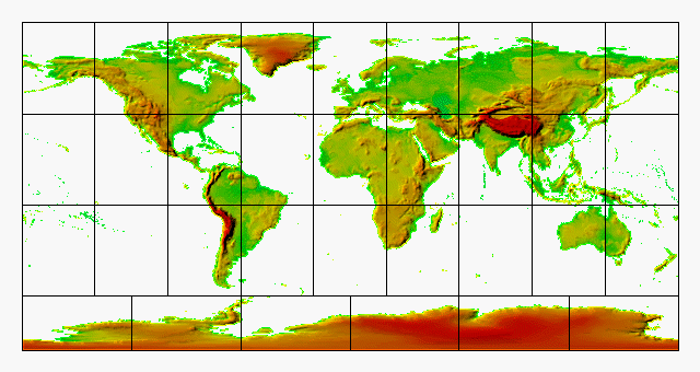
SoaringPilot uses 30 arc second .DEM formatted data to produce the sub-sampled terrain data. You can use the below image map to download the areas of the world that you wish to use. Instructions for creating the terrain data for SP with these .DEM files can be found in the Readme.pdf file included with software.